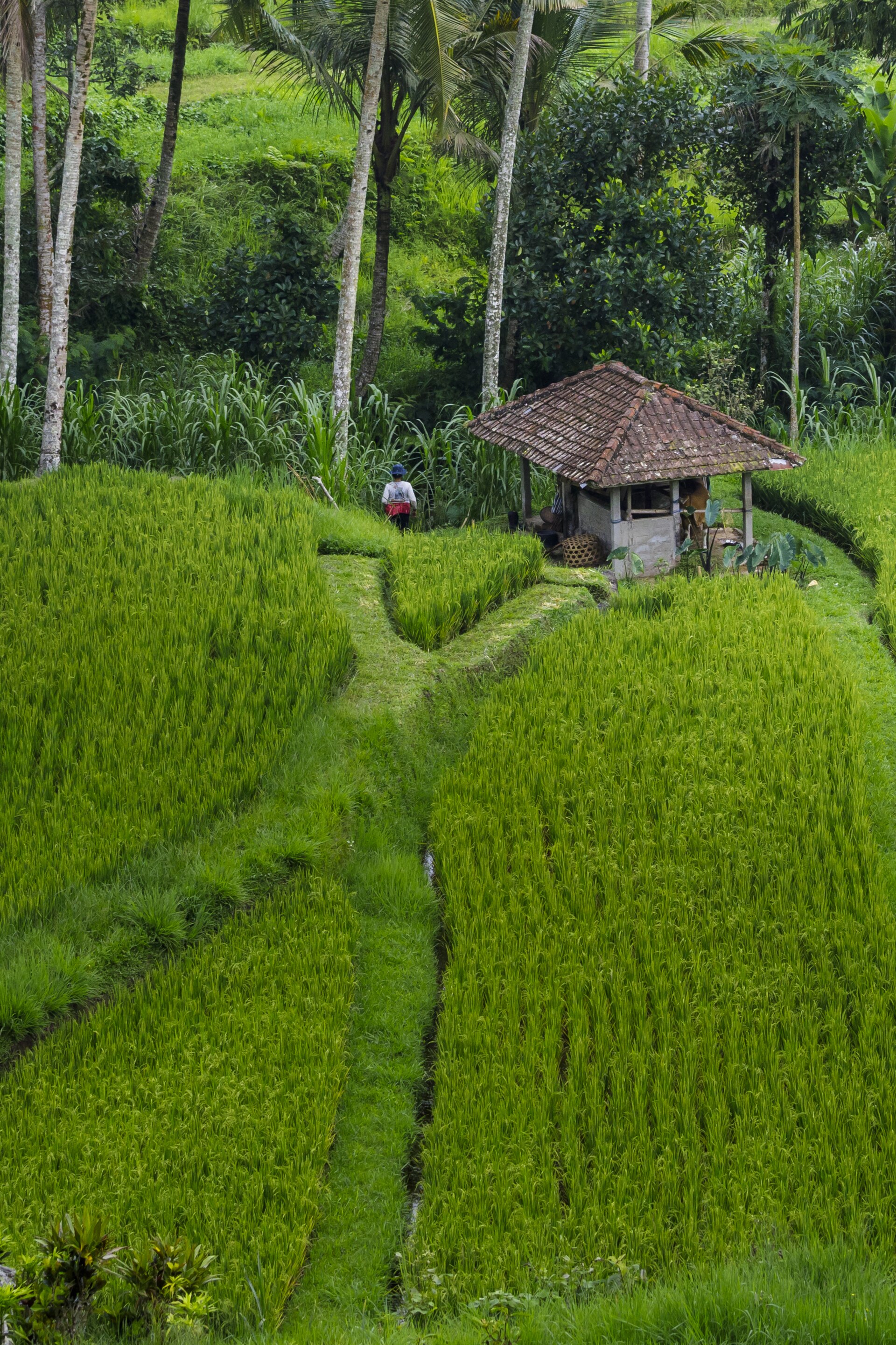
Jatiluwih is the rice terrace people picture when they imagine Bali and then rarely actually visit — because it's a 90-minute-plus drive from the tourist south and there are no Instagram swings. That distance is the whole point. What you get is a vast, working farm valley the size of a small national park, gloriously short on crowds, where the terraces roll to the horizon instead of dropping into one photogenic gorge. If you've only got a snapshot, go to Tegallalang. If you want to walk into the landscape, come here.
Jatiluwih vs Tegallalang — pick the right one
This is the decision that trips people up, so lead with it. Tegallalang (near Ubud) is small, steep, dramatic, ten minutes off the main road — and mobbed, with swings and "donation" checkpoints all the way down. Jatiluwih is enormous, gently rolling, UNESCO-listed, and genuinely peaceful, but it's a real drive and the scenery is broad rather than jaw-on-the-floor vertical.
Note
Short version: Tegallalang for a quick, punchy photo; Jatiluwih for a half-day walk in real countryside. Doing both in one trip is redundant — they're the same crop, very different experiences. Choose by how much time (and driving) you'll trade for calm.
Why it's UNESCO — the subak
Jatiluwih isn't protected for being pretty. It's part of a UNESCO World Heritage listing (inscribed 2012) for the landscape — specifically the , the roughly thousand-year-old cooperative that shares irrigation water between farmers through a network of channels, weirs, and water temples. It's democratic, temple-linked, and still running: the water reaching the paddy below your feet was allocated by a farmers' council, not a government pipe. That living system is what you're actually looking at.
The terraces here also grow Bali's heirloom red rice (beras merah), a taller, lower-yield traditional variety kept alive partly because of the heritage status. You'll see it sold in shops around the entrance — a legitimate local buy, unlike most souvenir-stand fare.
The walking loops
The best thing to do at Jatiluwih is the one thing most day-trippers skip: actually walk it. There are several colour-coded trails leaving from near the ticket area and car park, from a short 30–45 minute loop to longer routes of a couple of hours through the paddies and past a small water temple.
| Short loop | ~30–45 min, mostly flat, paved paths — enough to get in among the rice and away from the road |
|---|---|
| Long loops | ~1.5–2.5 hrs (colour-marked); rougher, quieter, better the further you go |
| Terrain | Gentle overall but paths can be muddy/slippery after rain — proper shoes, not flip-flops |
| Shade | Very little. Go early or bring sun cover and water |
Tip
Easiest way to do it is as part of a highlands day tour with a driver — Jatiluwih pairs naturally with the lake temple Ulun Danu Beratan and the Bedugul highlands, and a driver removes the two-hour parking-and-navigation headache of getting there yourself.
Book a guided day tripCheck availabilityWhen to go — and when it's green
The terraces change completely with the rice cycle, and the "endless green" photos are a specific window, not a guarantee.
| Greenest | Roughly a few weeks after planting through mid-growth — often best around Feb–Apr and again mid-year, but it's staggered field by field |
|---|---|
| Harvest / brown | Just-harvested paddies are stubble and mud — still atmospheric, but not the postcard |
| Best time of day | Early morning (soft light, fewer people, cooler for walking) or late afternoon |
| Weather | Highland cloud rolls in by midday; mornings are clearest |
Because the subak staggers planting, some part of the valley is usually green even when neighbouring fields aren't — one more reason the sheer scale here beats a single-gorge viewpoint.
Getting in, getting there
| Entry | Around 40,000–50,000 IDR per adult, collected at a gate on the access road (cash) |
|---|---|
| Drive time | ~1.5–2 hrs from Ubud, ~2–2.5 hrs from Seminyak/Canggu; ~40 min from Bedugul |
| Facilities | and cafés along the ridge with terrace views — a buffet lunch here is a genuinely good stop |
| Time needed | 2–3 hrs to make the drive worth it; a full highlands day if paired with Bedugul |
Watch out
The access road is narrow, winding and steep in places — fine in a car with a driver, but a nervier ride on a scooter if you're not confident, especially wet. There's no "scam" scene here like the southern hotspots, just genuinely rural roads. Fuel up and download offline maps before you leave the main highway.
Is it worth the drive?
Honestly — only if you'll get out and walk, or you're already heading up to Bedugul. As a drive-up-take-one-photo-leave stop it's a lot of car time for a view you can half-approximate closer to Ubud. As a morning walk through a living UNESCO landscape with almost no one around, it's one of the calmest, most quietly rewarding half-days in Bali. Set the expectation right and it delivers.
Go deeper
The newsletter
I'm writing Bali the way I wish someone had written it for me
The highlands, the terraces, the lake temples — one honest, been-there guide at a time. Want the next one?